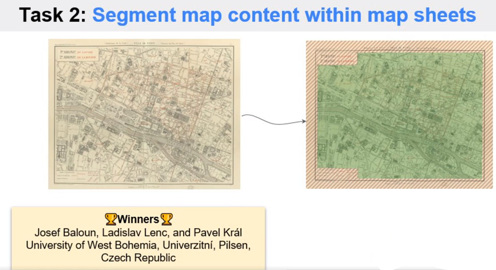
1st place in Task 2 of Historical Map Segmentation Competition
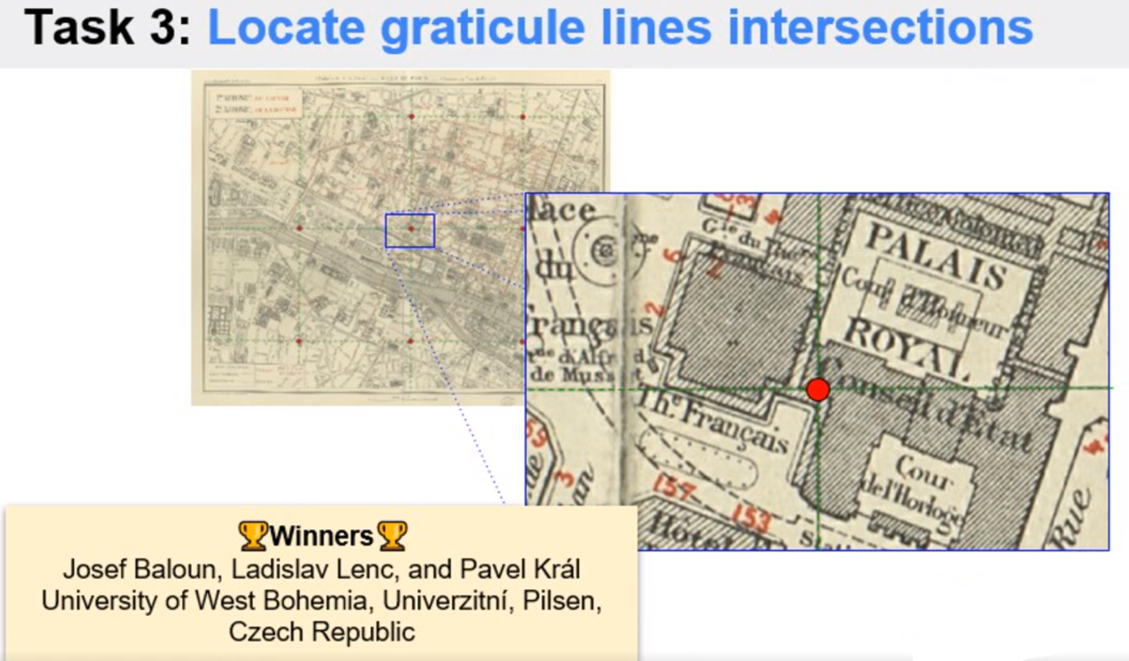
1st place in Task 3 of Historical Map Segmentation Competition
The MapSeg challenge ran from November 2020 to April 2021. This competition consisted in solving several challenges which arise during the digitization of historical maps. We were particularly interested in a large map series consisting in many Paris atlases over half a century (1860's-1940's).
For each year, a set of approximately 20 sheets forms a tiled view of the city. Such maps are highly detailed and very accurate even by modern standards.
This is the CodaLab Competition for SemEval 2020 Task 1 addressing the unsupervised detection of lexical semantic change, i.e., word sense changes over time, in text corpora of German, English, Latin and Swedish. The task is organized by Barbara McGillivray, Dominik Schlechtweg, Simon Hengchen, Haim Dubossarsky and Nina Tahmasebi.
The past decade has seen a rise in academic work focussing on the computational tackling of lexical semantic change. An overview of the literature until 2018 is available in Tahmasebi et al. (2018) and Kutuzov et al. (2018). Nonetheless, most studies have different evaluation procedures and tackle different languages, corpora, and periods, making systems difficult to compare. This SemEval task aims to introduce a simple evaluation framework for unsupervised lexical semantic change detection.
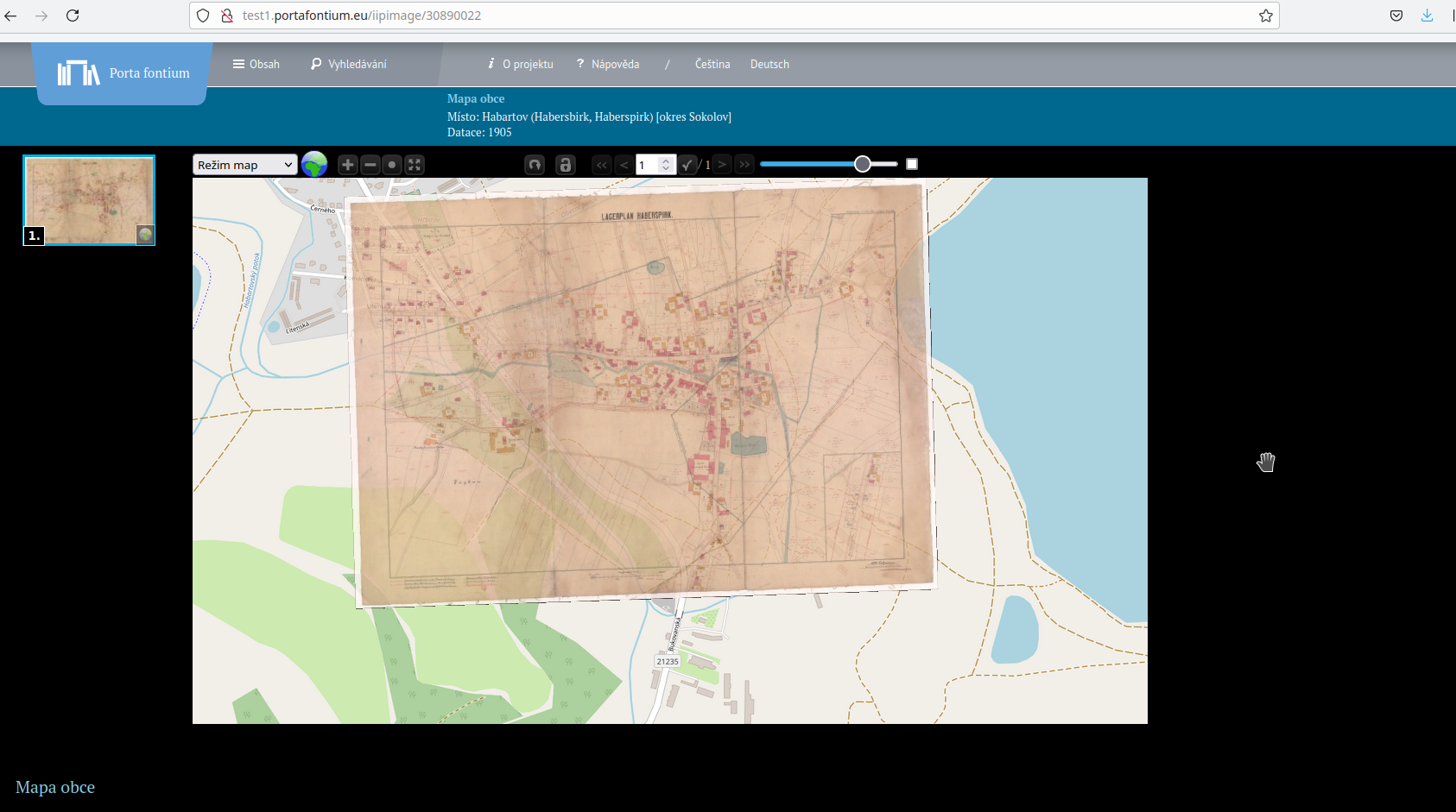
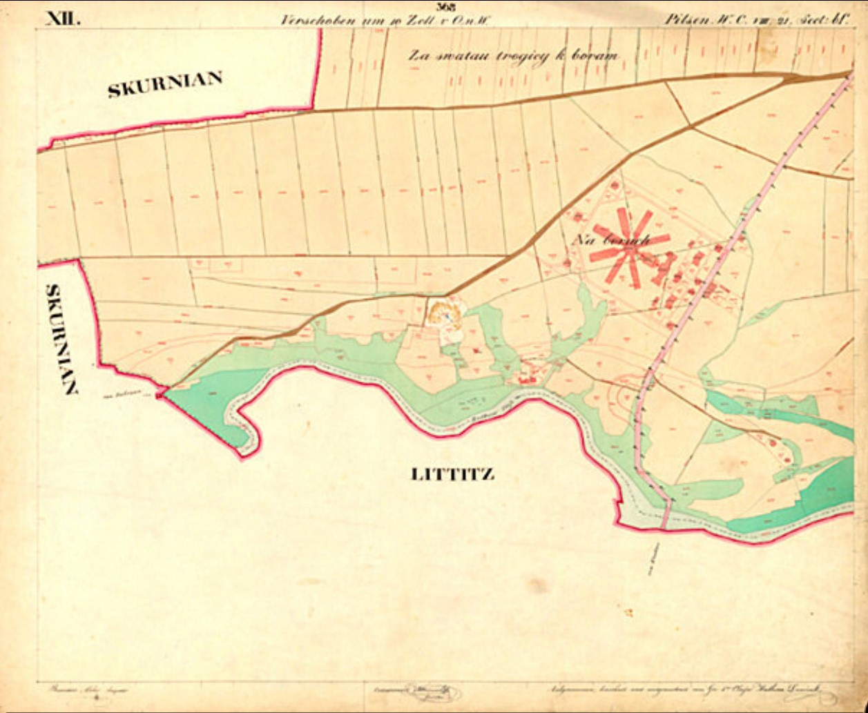
Díky spolupráci výzkumníků z Fakulty aplikovaných věd (FAV) Západočeské univerzity v Plzni, archivářů ze Státního oblastního archivu v Plzni a bavorských státních archivů a historiků najde na webu odborná i laická veřejnost kromě matrik, kronik, listin, úředních knih nebo periodik také na 7800 historických map a plánů do roku 1918. Portál nově umožňuje pokročilé dvojjazyčné vyhledávání, a to i na základě lokalizačních údajů.
Dohledat, jak vypadala obec v první polovině 19. století, kudy vedly cesty a jak se kde říkalo, umožní projekt Západočeské univerzity v Plzni. Odborníci z Fakulty aplikovaných věd ve spolupráci s firmou Gepro vytvořili technologii a softwarové nástroje pro zpracování a souvislé zobrazení katastrálních map z let 1826–1843.